

Apple Malaysia just announced via a news announcement sent to media that starting 23 May, transit directions are officially live in Malaysia.
Now you can get step-by-step directions for buses, light rail, ferries, and more in Kuala Lumpur, Penang, and Johor Bahru on Apple Maps.
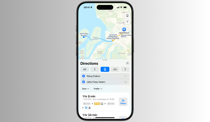
You’ll even see estimated arrival times and scheduled departures. And they’ve added support for Malaysia’s National Rail too.
Here’s a quick rundown of the transit options available:
Bus
AEROBUS, Airport Coach, Bas Muafakat Johor, Land Transit Authority Bus, Causeway Link, Causeway Link Airport Shuttle, Go Genting Express Bus, GOKL City Bus, KR Travel & Tours, MARALINER, MRT Feeder Bus, myBAS, PJ City Bus, rapidKL Bus, rapidPenang, Ridewell Travel, Singapore-Johore Express, SkyBus, SMART Selangor, Selangor Bus, Star Shuttle, Suasana Edaran Express, Transtar Cross Border, Wawasan Sutera
BRT
BRT Sunway Line
Ferry
Alibaba Pulau Ketam Ferry, Penang Ferry
Rail
KLIA Ekspres, KLIA Transit, KTM Electric Train Service, KTM Intercity, KTM Komuter
Light Rail
LRT Ampang Line, LRT Kelana Jaya Line, LRT Sri Petaling Line, MRT Kajang Line, MRT Putrajaya Line
Funicular
Penang Hill Funicular Railway
Gondola
Resorts World Genting
Monorail
KL Monorail Line